Tag: route

  • The Greenway (proposed) Route

    The Greenway (proposed) Route

    In a perfect world, we could draw a line on a map and, after a bit of to-ing and fro-ing, build a beautiful path through the countryside to be enjoyed by all as they walk wheel and cycle between Wellington and Taunton.

    Of course, this is a far from perfect world and without that line on the map there is no starting point and nothing to which we and hundreds of others can aspire.

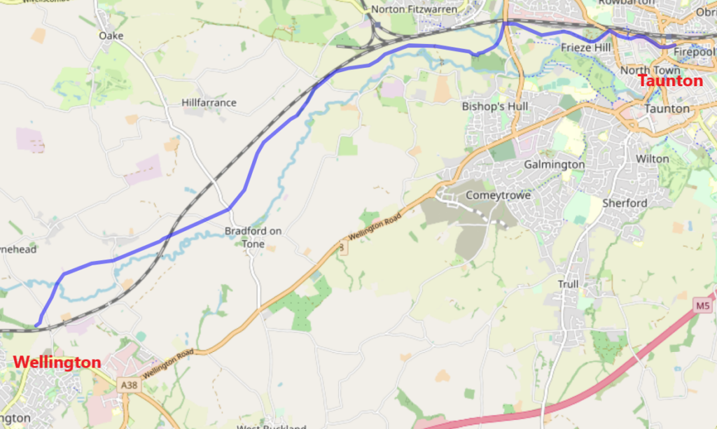
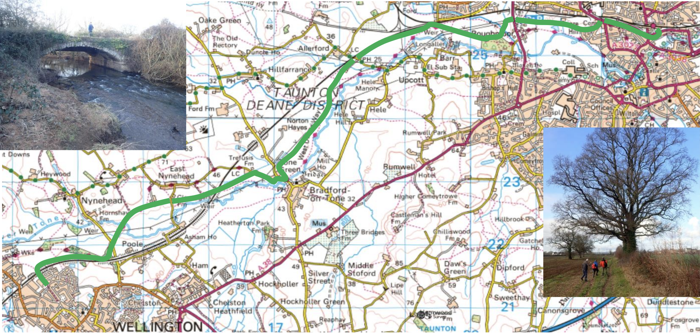
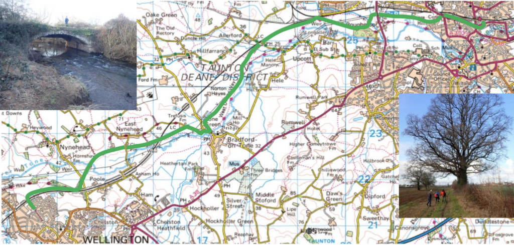
    In this post I want to talk about a route through the Tone Valley from Tonedale in Wellington to Taunton Station. In conjunction with Greenways and Cycleroutes Ltd and the renowned path builder John Grimshaw CBE, we have studied an outline route with some options.

    Our goal has always to do more than build a linear route between Wellington and Taunton. We want to connect several communities along the way and have mapped out possible routes to bring Wiveliscombe, Langford Budville, Milverton, Nynehead, Hillfarrance, Oake, Bradford on Tone, Bishops Hull and Norton Fitzwarren on to the main route through a series of ‘behind-the-hedge’ paths and quiet lanes. By connecting the Greenway to these communities, it will small communities to each other and to Wellington and Taunton in turn.

    Map showing connections from rural communities to the Greenway. The inset shows some of the route options to Musgrove Par Hospitaland Taunton College across Roughmoor.

    I can imagine a few sharp intakes of breath at the scope of the project, but we have to remember that one third of all journeys are done by active means and that these paths could improve the lives of a population in excess of 100,000 (Taunton Local Community Network – 74,000. Wellington and Wiveliscombe Local Community Network – 27,000 (Somerset Council))

    Many people want to create active travel routes. In Somerset there are campaigns everywhere, all with laudable goals to offer a traffic-free piece of infrastructure to serve the walker, wheeler, and cyclist. The Government is more committed to seeing this happen in England with the publication of a draft Cycling and Walking Investment Strategy. Although by no means perfect, it refers to the potential success of projects that are “coherent, connected, consistent and accessible to all” and should link to key destinations such as rail and bus stations, hospitals, and schools.

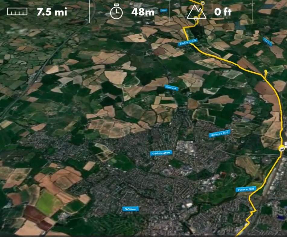
    It is hard to imagine a project that better fits this description than the Grand Western Greenway. If you want to see an interactive map of the route pictured above, see our website (below)

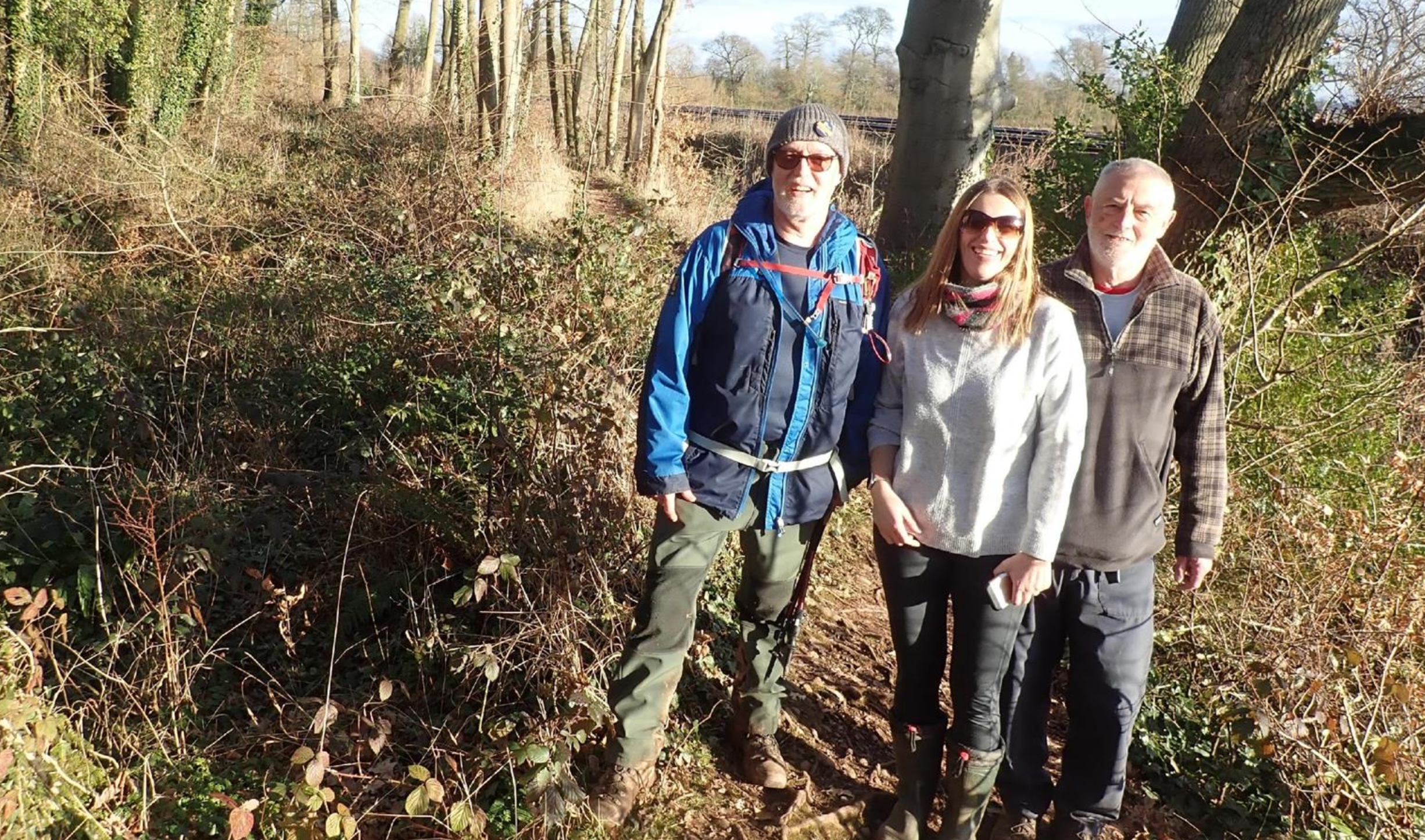
    Let us have a quick walk-though starting in Wellington. Bear in mind, this is entirely dependent on landowner permissions and planning permissions!

    Tonedale (phase 1)

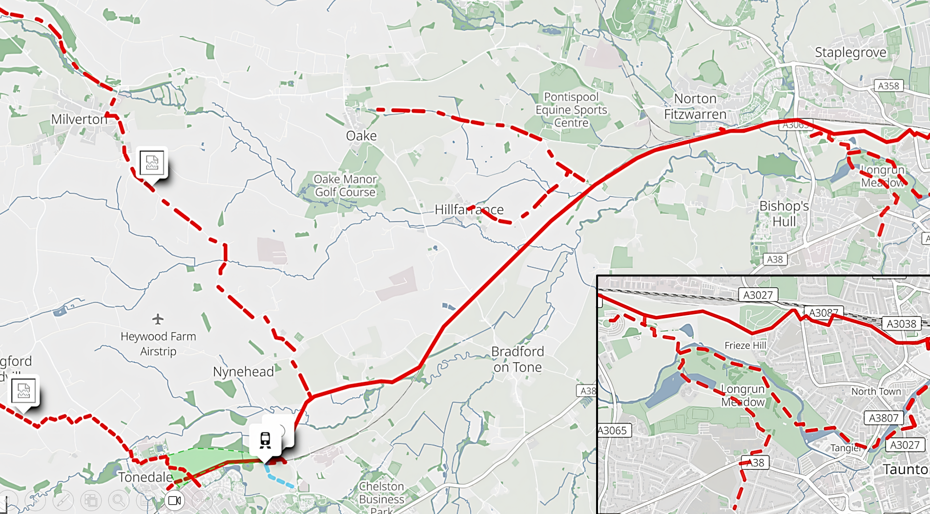
    When Network build the Wellington Station starting in 2026, they will almost certainly build a ‘haul-road’ from Tonedale to the station site on the north side of the railway. They have agreed to leave that in place rather than remove it as they would normally. West of England Developments have planning application before Somerset Council to build a number of homes in this location, and their Active Travel Plan (every application has one) involves incorporating this haul-road into it. After the station, we would continue along the north side of the Nynehead boat lift to the Nynehead Road to connect with the existing public right of way to the East Nynehead Road.

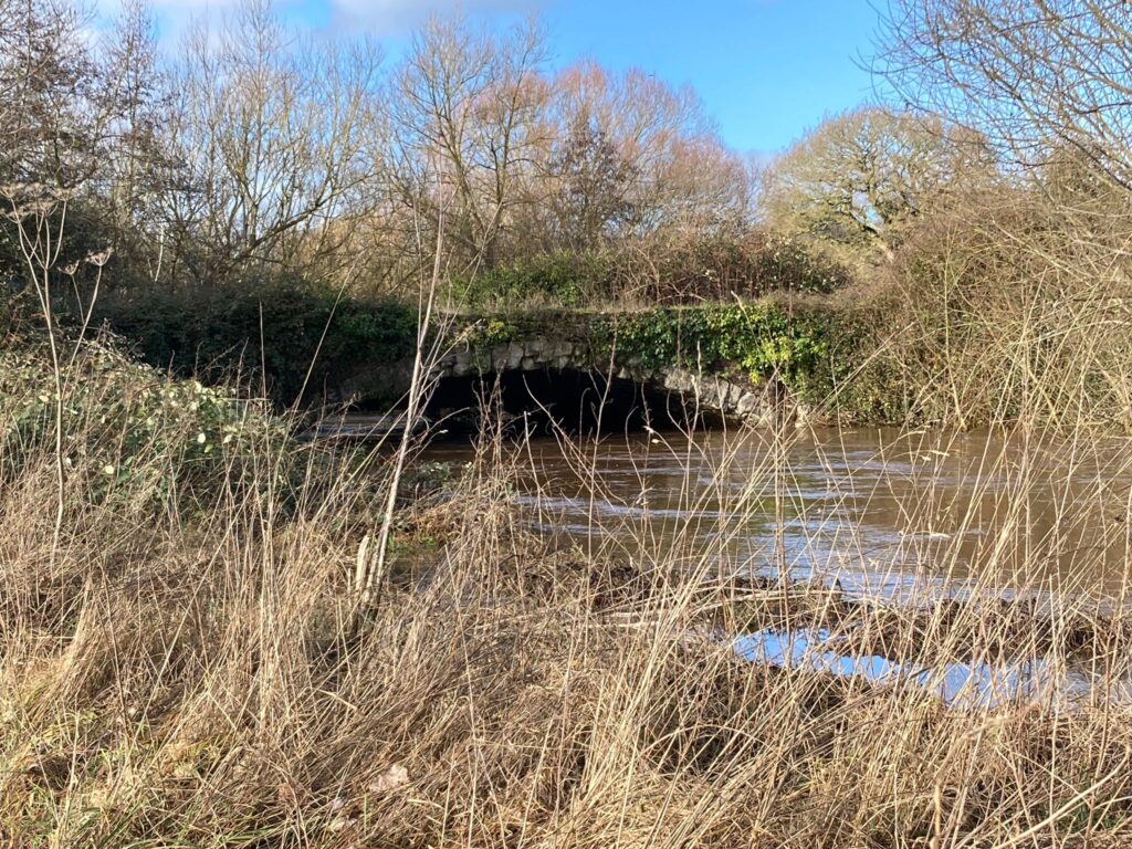
    We would then hope to follow the route of the defunct Grand Western canal to Tone Green and continue along the north side of the railway to the Oake / Bradford on Tone Road. This is the only practical rail crossing which, while not perfect, could accommodate safe passage from the north to the south.

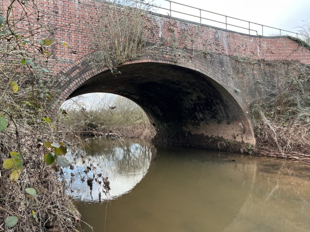
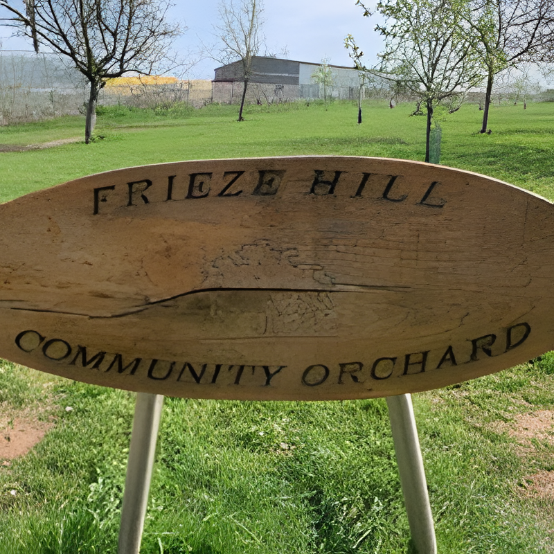
    We follow the railway along the south side to Allerford and on into Silk Mills. Wessex Water have given us permission to incorporate the access to their pumping station at Silk Mills to get us under the bridge. From there we would pick up the existing bridleway across Frieze Hill to Staplegrove Road.

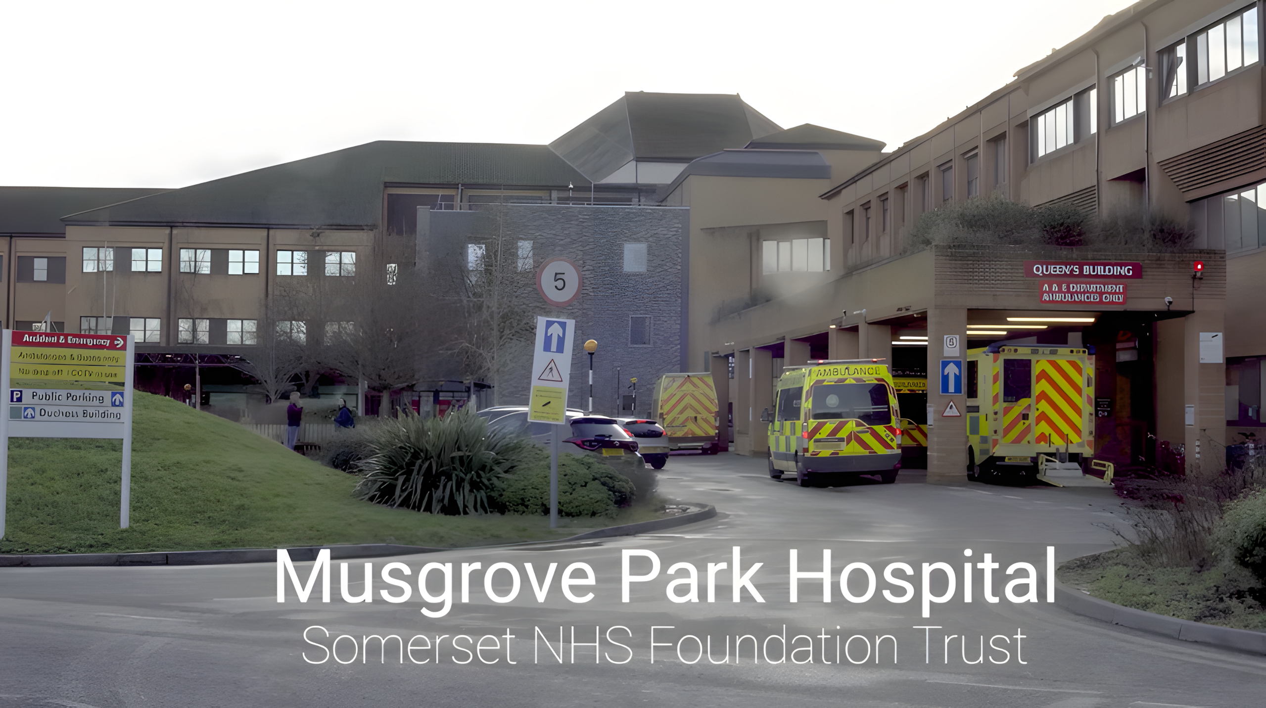
    The route to the station already exists along Trenchard Way, although it would be desirable to incorporate the paths (upgraded) over Roughmoor to the hospital and College.

    From the station to the centre of town, a new route is already under construction as part of the Garden town investment and will see a much-improved bridge being installed (hopefully in 2026) at the Morrisons / Brewhouse juncture.

    Interesting? Raises more questions than it answers? Then why not join us at a Public Meeting in Wellington on 24th January 2 – 4pm. It will be in the 1st Wellington Scout HQ, 6 Fore Street (behind the Co-Op)

  • Greenway Update

    Greenway Update

    Railway Station

    We can’t even begin to express our joy at the announcement that Wellington will have its railway station reinstated!

    For us it means the developments around it will almost certainly go ahead on both sides of the line, and this means the haul road the Network Rail will build will become incorporated into the active travel plan from the station to Tonedale.

    By coincidence, this also happens to be the first 500m of the Greenway, and will provide links to the Toneworks development as well as the natural joining spot for a proposed path from Langford Budv ille to Wellington.

    Are you a landowner?

    If so, if your land is along the river valley from Wellington to Taunton, we would love to hear from you. We don’t really know the route of the proposed Greenway, but we have many thoughts and ideas which will doubtless mature as we discuss these with you. Four significant landowners have already indicated their wish to accommodate this project, but we need to talk to everyone, and to get those talks going very soon.

    Walk the Greenway

    The next (and probably last for 2025) walk along the Greenway is planned for 16th August.

    Linking Communities

    The Greenway has never been solely about getting from Wellington to Taunton. Our plan has always included linking many smaller communities in the area either along separate paths or by making use of Quiet Lanes. Have a look at the recently added interactive map on our website to see some of the suggestions being discussed in local government and beyond.

  • Spring Greenway update

    Spring Greenway update

    Wellington Station

    I’ve made a few mentions about the station and its precarious journey to being built over the last year or so, but it is worth mentioning again. Although it would indeed be a bonus to add this to the public transport mix for Wellington, it is not vital for the Greenway. Yes, it would mean a haul-road would be built which we would adopt but, as I mentioned before, the proposal to build housing on the north side of the line would have to include an active travel plan. The developers are supporters of the Greenway, and their plans indicate they would either upgrade the haul-road or build their own path from Tonedale to the Nynehead Road.

    Nevertheless, the Department for Transport has not shut down the Wellington Station negotiation. The Chancellor specifically singled out developments around transport hubs to boost growth, and there is no better example of this than Wellington. Gideon Amos MP has met the railway minister Lord Hendy several times, and is due to so again this week. This time he is taking a coachload of his constituents, and I’ll be there pushing the case for active travel.

    Somerset NHS Foundation Trust supports the Greenway

    The Trust that delivers all acute secondary and some primary care across Somerset is the largest emplyer in the county. Their Chief Nurse and Chief Executive agreed to an interview in which they discussed their support of the Greenway and the benefit it will bring to their patients and colleagues. The video is still being edited, but you can have a sneak peek here

    Route and Engineering Assessment 

    Again, I’ve written about the work being done by Greenways and Cycle-Routes Ltd. Their principle, John Grimshaw (founder and former CEO of Sustrans) will report over the next month or two, and we are hoping to discuss this and other issues at public meetings over the summer in Taunton and Wellington. Are you interested in this?

    Somerset Council Active Travel Team

    It appears that, after a number of people moved away from the AT Team last year, recruitment has seen the appointment of three new officers. They are clearly very busy because, despite a number of attempts by us and councillors, we have yet to make contact with them. Let’s hope that is just a temporary hiatus as they settle into post, and that we can get talking very soon.

    Public Talks and Presentations

    we are pleased to report we have now spoken to every Rotary Club (I think) in Wellington and Taunton. They have been kind enough to show great interest in the project and have demonstrated their support. Wellington WI have done the same, and we are always very happy to come and spread the word if you have groups that would be interested.

    Throughout the summer we hope to get to more public events such as street fairs markets. We are negotiating with some of the larger employers such as Musgrove Park Hospital and the Hydrographic Office to operate a display in their public spaces. If you would like to help out with any of those, we would be very happy to see you!

    That’s it for this week, but let me have your questions and comments which I will do my best to answer.

  • The Latest Developments in Our Greenways and Cycleroutes Project: An Update on Progress and Future Plans

    The Latest Developments in Our Greenways and Cycleroutes Project: An Update on Progress and Future Plans

    Many of you will know of the work commissioned by Grand Western Greenway in collaboration with Greenways and Cycleroutes Ltd is that is an important step towards exploring route options and assessing engineering challenges. This report will guide us as we move forward in negotiations and implement practical solutions.

    The completion of this report will clarify which stakeholders need to be consulted for access permissions across various lands. Additionally, it helps us address practical issues like flooding, road and river crossings, and planning for future maintenance.

    A heartfelt thank you goes to both the Wellington and Taunton Town Councils for their generous funding. Their support is crucial in helping us make significant advancements.

    Current Progress on Route Planning

    We are pleased to share that we have secured permission to begin the planning phase for paths at both ends of the project. This includes a proposed route from Taunton to Silk Mills and one from Wellington to Nynehead Road. These developments are a major step toward making the Greenway a reality.

    In discussions with a developer currently at the pre-planning application stage, we’ve found promising cooperation. The developer plans to build new homes on the north side of the railway line in Wellington, stretching from the station site to Tonedale. They have included the Greenway in their development plans, regardless of Network Rail’s plans for a halul-road in that area.

    Outline plan for a development north of the railway line

    The proposed Greenway is shown on the map with a blue dotted line. Existing footpaths are marked in yellow, while the thick orange line represents the Bristol Exeter railway line. On the western side, you’ll find Tonedale, with Nynehead Road to the east. 

    In addition, Langford Budville Parish Council has an initiative to create a path connecting their community to Tonedale. A vital part of the developer’s proposal includes integrating a pathway from the Sewage Treatment Plant access road into the housing site. This will provide users direct access to the Greenway, the railway station, and the town, eliminating the need to navigate the busy B3187. This creates a safer environment for pedestrians.

    Community Engagement and Membership Drive

    Connecting with the community and increasing membership support is a priority we take seriously. Our approach includes participating in various events and discussions throughout the year.

    In just this past year, we have visited almost all the Rotary Clubs in both Wellington and Taunton. These visits are an opportunity to raise awareness about the Greenways and Cycleroutes project and discuss its community benefits.

    Through these engagements, we share insights on the planned pathways, showcasing how they can improve local connectivity and promote cycling and walking in the area. Engaging the community inspires more residents to contribute to our mission.

    Overcoming Engineering Challenges

    The ongoing report from Greenways and Cycleroutes Ltd focuses on identifying practical engineering challenges. Recognizing these hurdles early will allow us to devise effective strategies.

    For instance, we aim to address potential flooding areas and plan safe roadway crossings for everyone. We are also assessing the logistics surrounding river crossings. By tackling these factors early on, we can create a well-constructed and sustainable route that benefits the community for years.

    Railway bridge over the River Tone

    Understanding these challenges will also aid our discussions with landowners and stakeholders. By being prepared, we can offer solutions that align with their interests while advancing our Greenways goals.

    Walk the Greenway

    If you haven’t already done so (or maybe you have and want to do it again) we will be Walking the Greenway on Saturday, 15th March. It will get as close as we can on public footpaths, but gives a pretty good idea of exactly why we work so hard to achieve this route as an accessible route for all. 

    The walk is about 8.5 miles from Wellington to Taunton leaving at 09:30 and arriving between 1:30pm and 2:00pm. The return trip is by bus unless you make other arrangements.

  • How we plan the route

    How we plan the route

    If you’ve walked the Greenway with us, you will know there are many options for route selection. It would be wonderful to simply follow the route of the Grand Western Canal, but the topography today is much different now to what it was in the 1840s. Agriculture uses enormous arable fields through which the canal route would cut striaght through the middle, and the parts of the canal that remain are too precious to degrade further.

    It is likely we will use many public rights of way which incorporate the canal route, but there are some parts where we have to move away from the river to overcome flooding problems.

    One major obstacle to overcome is the Bristol to Exeter railway line. the canal was built long before the railway, so Brunel put in a tunnel through the embankment to accommodate it. This remained for the best part of 100 years until it was back-filled in the 1970’s to strengthen the line for high-speed trains. Although very overgrown, we believe the portal still exists, but passage through the tunnel is a thing of the past.

    Of course, there are level crossings, but we would really like to use the same route through the embankment as the one used by the River Tone at Pickings Bridge. Is that possible? Who knows, but we hope to find out.

    Getting past the railway line is one thing, but avoiding the areas most prone to flooding is another. It seems likey our route may move to the north at Allerford and follow the line of the railway into Silk Mills, and then across Frieze Hill into the Firepool along Trenchard Way.

    At this stage we have no certainty so, to gather more information about the engineering and access issues, we are hoping to commission Greenways and Cycle Routes Ltd to survey the route and create recommendations about practical options. We have applied to Somerset Council for funding from the grant they received from Active Travel England for such work, and are hoping for a response fairly soon.

    If you would like to know more about the route and the countryside through which it will go, why not join us on one of our Walk the Greenway events

    In the meantime, we are very grateful to those people who help to support our work with dontaions. If you would like to become one of those, please use the link below and accept our grateful thanks.

  • Greenway progress report

    Greenway progress report

    Wellington – phase 1

    This illustration of the new Wellington station was provided by Network Rail as part of the planning application for the recently approved housing development. It is important to note that this is purely a representation and not the final design.

    Nevertheless, if we assume we are looking at the south side (i.e. the Wellington side) and the land to the north is open country, Network Rail will be building a haul road to facilitate construction. We aren’t quite sure where it will join the road network, but we are confident it will run from the Longforth Bridge over the line, and alongside the track to this point.

    It has been communicated to us that Network Rail has decided not to dismantle the road, which is the standard procedure. A development firm interested in the land on the northern side has committed to improving the road and integrating it into the area to establish a direct travel connection between the housing and the town.

    We have an agreement with the owners of the Nynehead Boat Lift to have access around the lift out onto the Nynehead Road. There are some details to iron out about further access, but we may have come very close to establishing a link from Longforth to the Nynehead Road. The next part will be from there to Nynehead, thus establishing a traffic-free route between the village and Wellington.

    The Taunton End

    For those of you who have walked the walk with us, you will know that the path aims to cross the southern boundary of the Frieze Hill Community Orchard along the public bridleway to Staplegrove Road, next to Turner’s Allotments.

    We had a very constructive meeting with representatives from the Orchard and the Allotments to discuss the nature of the path, the way it is constructed, the types of fencing we would use, and future maintenance. I think it is fair to say we were able to answer their questions in a way that alleviated any concerns they may have had.

    As we reported recently, Taunton Town Council has given us their support in writing as we begin to discuss our aspirations with the public rights of way team at Somerset Council. We appreciate we have further discussions to have with homeowners and other stakeholders, but we see some real progress in establishing a route through to the Silk Mills Road.

    Walk the Greenway

    New dates are on our website to Walk the Greenway in June, July, and August. If you haven’t done so, have a look and see if it is for you. 8.5 miles of flat walking taking about 4 hours, followed by a very nice bus trip back to Wellington. Details here

    Feasibility Studies

    When planning a route such as this, we will rely on the expertise of others to a large extent. Our partnership with Greenways and Cycle Routes Ltd is one such example.

    John Grimshaw, the man on the left in the image, is the founder and director of Sustrans. He is credited with establishing the Bristol to Bath Cycle Path and numerous others throughout the country. A civil engineer by profession, John is featured in the newest section of the Strawberry Line leading to Wells. Together with Caroline Levitt, he leads Greenways and Cycle Routes and has welcomed us as one of their partners.

    We plan to commission these studies to provide more certainty to the route and identify obstacles. Somerset Council has received a £400,000 grant from Active Travel England for route development, and we will apply to them for funding, but there is no guarantee of success.

    Nevertheless, conducting a campaign incurs expenses. While we have received generous support from a few organizations (Wellington Town Council, Taunton Town Council, and Somerset Community Fund), we constantly require additional funds to sustain our efforts.

    We appreciate any donation, regardless of its size, as a sign of the genuine support we have received from our supporters, both currently and in the future.

  • Wellington Station and the Greenway

    Wellington Station and the Greenway

    The new railway station planned for Wellington makes a cycle route between the town and Taunton a real possibility.

    The new railwaystation planned for Wellington ‘boosts the argument’ for a cycle route between the town and Taunton.

    That’s the view of campaigners who want it to follow the grand western canal – rather than the busy A38 as had been originally looked at (see below). 

    At the weekend the first in regular guided walks – along the proposed route – took place so potential users could see the benefits. 

    The proposed new route would connect with the new Wellington train station, which the Government recently gave the go-ahead for. 

  • Feasibility Study, for want of a better name…

    Feasibility Study, for want of a better name…

    In 2022, the long standing campaign to see a cycle route built between Wellington and Taunton focused on a route alongside the A38. Somerset Council pledged to establish the route by 2025, although this has slipped and slipped as all pledges do.

    The most recent development at a cost of £50,000, has been made by the Council to commission a Strategic Outline Business Case (SOBC), the purpose of which is to be prepared for submission to the Department for Transport (DfT) in the event of competitive funding becoming available – an ‘oven-ready’ plan! There is no such funding at the moment, and the SOBC has been delayed by several months before it made any real progress.

    The firm of consultants preparing it, Stantec , are briefed to put forward a plan for’ improving sustainable transport between the two towns, and this is suitably vague so that everything, including cycling, can be looked at. We would have preferred them to focus solely on creating a cycle and walking path, but this specification as it is could include rail travel, bus travel or, as one officer recently said in jest, ‘the addition of anothe rcar lane on the A38!’ 

    Nevertheless, the SOBC (or feasibility study as we would prefer to call it) is underway, and making progress towards a set of stakeholder workshops. The Grand Western Greenway Association has submitted a proposal document to Somerset Council and to Stantec. We have engaged with our pratners as we developed it, and you can download it below.

  • What’s the purpose of a Greenway?

    What’s the purpose of a Greenway?

    Wellington is a substantial town 6 miles from the county town of Taunton. It is proposed to establish a predominantly traffic-free greenway between them along the route of the disused Grand Western Canal. Wellington will have a new railway station by 2025 which would mark the starting point, and it would end at Taunton Railway Station giving access to both town centres

    Sustainable transport initiatives in the coming years mean that more will be cycling from Wellington to Taunton,

    • the canal corridor provides a level route separated from most traffic,
    • its heritage and wildlife assets make it also ideal for recreational use,
    • It will provide 6 miles where walkers and cyclists can exercise without traffic noise and fumes,
    • it will link Taunton station and the new Wellington station for benefit of visitors
    • links with other local community initiatives (Friends of the Grand Western Canal, the Wellington Green Corridor) will provide opportunities for business development along the route.